CHC AlphaAir 450

Brand:

Call Me
Kode Produk:

Stok: Stok Tersedia

Berat: -

Sejak: 27-05-2024

Call Me
Wishlist
Butuh bantuan?
Support produk siap membantu.
Whatsapp
Telp

Detail Produk

ADVANCED ACCURACY
Industrial-grade GNSS and high-precision IMU onboard
High accuracy INS is essential to collecting quality LiDAR data, because without it, point cloud would be nothing more than an arbitrary collection of points. It allows the AA450 to provide an absolute accuracy of 5 to 10 cm. With advanced calibration and point cloud optimization technology, the thickness (range noise) of the point cloud is only 30% compared to similar products, which effectively improves the precision of the collected data.  
EFFICIENT SCANNING
Long range scanning combined with high resolution imaging
Users will obtain a long-range scanning up to 450 m with a high point's density on the measured surface. At a flying height of 100 m and a velocity of 5 m/s, the AlphaAir 450 (AA450) can deliver around 280 pts/m2 density. The built-in 26 MP high resolution camera has the same FOV width as the Livox LiDAR to provide complete point cloud coverage by RGB colorization.
FLEXIBLE INTEGRATION
Quick installation on any UAV
AlphaAir 450 is ready for direct connection to a DJI M300 via its integrated Skyport. Moreover, it can be installed on CHCNAV's BB4, other multirotor and VTOL UAVs easily. Finally, it can be fitted on any multirotor and fixed wing VTOL drones that can support its weight with dedicated mounts to attach it.
LIGHTEST UNIT IN ITS CLASS
1 kg total weight with LiDAR and camera
The design of the AlphaAir 450 continues to follow the rule - the lighter the unit, the higher the productivity, as the drone can fly longer. As an example, the DJI M300 with the AlphaAir 450 can fly for 30 minutes and collect data covering an area of 2 km2. If users choose the CHCNAV’s BB4 UAV, its endurance with the AlphaAir 450 will reach 55 minutes.
3D POINT CLOUD PROCESSING SOFTWARE
Powerful and accurate 3D point cloud generation
CoPre is an advanced, user-friendly 3D laser scanning pre-processing software that can process captured raw data, including POS trajectories, LiDAR data, and RGB images. CoProcess is a reality capture post-processing software providing DEM/DTM generation, semi-automated feature extraction, automatic data classification, and dedicated power line and road inspection modules.  With its intuitive interface and efficient workflow, the software significantly improves the productivity of 3D mapping projects.
OVERVIEW

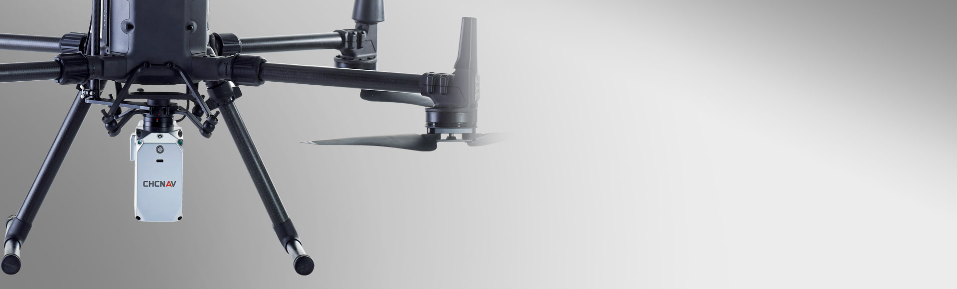
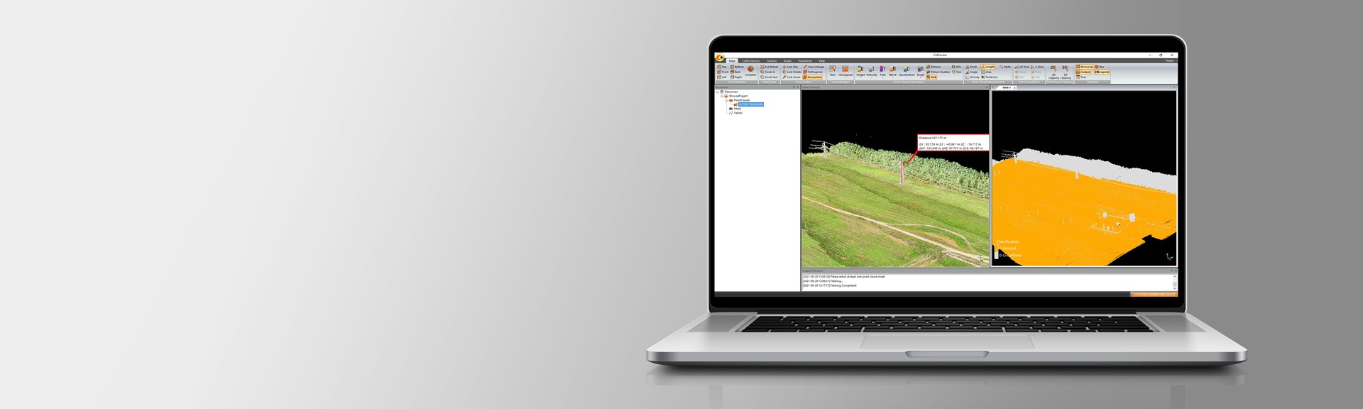
The AlphaAir 450 (AA450) is a significant breakthrough in 3D mobile mapping technology, allowing its use by non-professional users in geospatial reality capture applications and to those who have never been able to access such technology. The AlphaAir 450 offers ease of use and high-precision capabilities at an affordable price.

AlphaAir 450 is the next generation of the CHCNAV LiDAR system, widely used for power line inspection, topographic mapping, emergency response, agricultural and forestry surveys, and more. This all-in-one, lightweight, and rugged system integrates a high-performance laser scanner with an industrial-grade professional 26 MP camera and a high-precision inertial navigation system for quality data collection.


Further reading:

The documentation of archaeological heritage through aerial photogrammetry and UAS-based LiDAR in Spain.

Using the AlphaAir 450 to create a Digital Elevation Model (DEM) for a coal mine project.

The CHCNAV's mobile mapping solutions enable efficient and affordable mining exploration in Indonesia.

Join CHCNAV's Geomatics Community & Explore Dealership Opportunities.

Brosure

Butuh Bantuan?