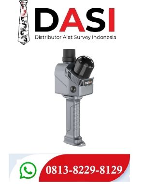

LEICA TS01
Detail Produk
Leica TS01: The entry to Leica Geosystems' Total Stations
Leica TS01 empowers you to carry out measurement tasks with ease and simplicity.

The Leica TS01 total station empowers you to carry out measurement tasks with ease and simplicity. The TS01 is an entry-level manual total station, created to help you master surveying, layout and mapping projects. It will prove itself in the field and immediately become a valuable member of your team.
Buying a Leica TS01 is a smart decision as it represents a business-smart entry into Leica Geosystems world. You and your surveying crew members will be ready for new projects in no time.
Enjoy the benefits of a 500 m non-prism range and 3,000 m prism range, always combined with accuracy and measurement speed, which increases your productivity. With built-in sensors like an electronic dual axis compensator, a laser plummet, onboard field software and short keys for quick menu access you'll have a fast instrument setup and fast measurements.
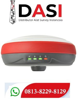
With the Leica TS01 total station you get your all-in-on package as it comes with Leica Geosystems accessories, such as a long-operating battery, a charger and a tribrach tested to reliably fulfil the requirements – when every detail counts.
First class after sales service and support
Leica Geosystems's highly qualified after-sales service and support network will help you managing any issue to continue work quickly.
Be it maintenance work, in any of our local service workshops, or getting a question answered from local support, both are part of Leica Geosystems's active customer care.
Start-up into business easily
Leica Geosystems' TS01 will get your trusted partner in managing survey, layout and mapping projects with ease and simplicity.
Powerful built-in sensors, as well as intuitive field software, empower you to complete tasks without any delay.
 Leica TS01 – Total Station Digital Presisi untuk Surveyor Profesional
Leica TS01 adalah total station manual dari Leica Geosystems (Swiss) yang dirancang khusus untuk aplikasi pengukuran tanah, konstruksi bangunan, pemetaan topografi, dan pekerjaan survey sipil. Produk ini memberikan akurasi tinggi dan kemudahan penggunaan, bahkan untuk pengguna pemula.
 Fitur Utama:
 Akurasi sudut hingga 5 detik (5”)
Jarak pengukuran prisma hingga 5000 meter
Pengukuran reflektorless (tanpa prisma) hingga 500 meter
Layar LCD besar dan antarmuka intuitif
Kompatibel dengan USB dan SD card untuk transfer data
Tersedia software Leica FlexField yang user-friendly
Ringan dan tangguh – ideal untuk lapangan
 Spesifikasi Teknis Singkat:
| Fitur | Detail |
|---|---|
| Merek & Model | Leica Geosystems TS01 |
| Akurasi Sudut | 5" (detik) |
| Jangkauan Pengukuran | 5000 m dengan prisma, 500 m tanpa prisma |
| Layar | Dual screen (depan & belakang), grafik, backlit LCD |
| Penyimpanan | Internal + SD Card + USB transfer |
| Software | Leica FlexField |
| Baterai | Li-ion rechargeable, tahan hingga 16 jam kerja |
| Konektivitas | USB, SD Card |
| Berat | ±5 kg (dengan baterai) |
 Cocok Digunakan Untuk:
-
Survey pemetaan tanah
-
Proyek konstruksi jalan dan gedung
-
Pengukuran lahan pertanian & irigasi
-
Pemula dalam pekerjaan topografi